Chinese researchers quantify water clarity with remote sensing data


BEIJING - Chinese researchers have mapped the country's water clarity of lakes and reservoirs in 30-meter resolution using remote sensing imagery data.
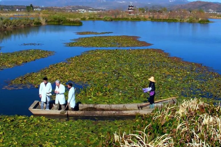
Water clarity is a reliable indicator for quantifying eutrophic status, said their recently published research article in journal Remote Sensing of Environment. The researchers from the Northeast Institute of Geography and Agroecology of the Chinese Academy of Sciences collected 2,152 samples from 34 field campaigns from 2013 to 2018.
Based on both measured data and Landsat OLI remote sensing data, they developed regression models to map water clarity with a 30-meter resolution at a national scale.
The research showed that the lakes in northeastern and eastern China had low clarity due to shallow water depth combined with high suspended matter and algal abundance.
Lakes in the Yunnan-Guizhou Plateau, Inner Mongolia Autonomous Region and Xinjiang Uygur Autonomous Region exhibited intermediate clarity, while lakes in the Qinghai-Tibet Plateau displayed the highest clarity, according to the article.
The Landsat imagery was demonstrated to be applicable in providing quantitative information about lake water clarity.
The research is expected to support inland water management and improve water quality.


- Experts urge stronger civil aviation legislation, cultivation of legal talents
- Henry C. Lee praises women's rising role in forensic science
- China's national college entrance exam begins
- China issues yellow alert for rainstorms
- 78,900 students across Beijing sit the gaokao
- Chinese, American youths bridge cultures through dance